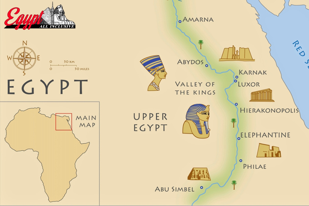
Ancient Egyptian map of Egypt searches spike every year among students, history lovers, and travelers planning a trip along the Nile, and 2026 is no different.
In this guide, you will get a clear, accurate picture of how ancient Egypt was laid out, from Upper and Lower Egypt to the Nile Valley, the deserts, Nubia, and every major city that shaped one of the world’s greatest civilizations.
In short: this article covers the geography of ancient Egypt, how its borders changed over time, and how understanding that old map can make your 2026 Egypt trip far more meaningful. By the end, you will not only understand the ancient world Egypt sat in, you will know exactly how to turn that knowledge into a real, unforgettable journey.
Whether you found this page because you’re writing a school report, planning a documentary, or booking a trip to see these places with your own eyes, you’re in the right place. Egyptians didn’t just build monuments; they built an entire civilization around geography, and once you see the map, everything about their history starts to make sense.
What Does the Ancient Egyptian Map of Egypt Actually Show?
When people search for a map of ancient Egypt, they usually picture a stretch of green land hugging a long blue river, surrounded by endless desert. That picture is essentially correct, and it explains almost everything about how the civilization developed. Unlike modern political maps that show straight borders drawn by treaties, an ancient map of Egypt is shaped entirely by nature. The Nile River cuts through the land from south to north, and the fertile strip on either side of it is where nearly all ancient Egyptian life happened. Step a few kilometers away from that strip in any direction, and you hit desert.
This is why a geography map of ancient Egypt always highlights three main zones: the Nile Valley, the Nile Delta, and the surrounding deserts. The Nile Valley is the narrow corridor of farmland running from the First Cataract near modern Aswan down to just south of modern Cairo. The Nile Delta is the fan-shaped area where the river splits into multiple branches before reaching the Mediterranean Sea.
Together, these two regions formed the backbone of the ancient Egyptian state, while the deserts on either side acted as natural walls that protected the kingdom from large-scale invasion for thousands of years.
A physical map of ancient Egypt also shows something that surprises many first-time readers: ancient Egyptians did not think of “north” and “south” the way we do today. Because the Nile flows from south to north, they referred to the south as “Upper Egypt” (higher up the river’s course) and the north as “Lower Egypt” (lower down, closer to sea level and the Delta). This single detail is one of the most searched points of confusion, and once you understand it, every map of ancient Egypt with labels becomes instantly easier to read.
If you’re looking at a blank map of ancient Egypt for a school project or trying to fill in a labeled map of ancient Egypt, start with three anchors: the Mediterranean Sea to the north, the First Cataract to the south, and the Nile River running down the middle. Everything else, cities, temples, deserts, and neighboring lands, is positioned relative to those three features.
This approach works whether you’re studying a simple map of ancient Egypt for a classroom assignment or a highly detailed map of ancient Egypt used in academic research.
Understanding this basic layout matters for travelers too. Every major site you’ll visit in 2026, from Cairo to Luxor to Aswan, sits along that same fertile strip the ancient Egyptians depended on. Their geography is still, quite literally, the map of your itinerary today.
Upper and Lower Egypt: Understanding the Ancient Map of Egypt in Two Kingdoms
No discussion of the map of upper and lower ancient Egypt is complete without explaining why this division mattered so much to the ancient Egyptians themselves. Long before Egypt became a single unified nation, it existed as two separate kingdoms.
Upper Egypt stretched along the narrow Nile Valley in the south, while Lower Egypt covered the wider, marshier Nile Delta in the north. Each kingdom had its own crown, its own patron symbols, and its own identity, and this duality never fully disappeared even after unification.
Around 3100 BCE, a ruler traditionally identified as Narmer (sometimes linked to King Menes) united these two kingdoms into one Egyptian state. This event is considered the true starting point of ancient Egyptian civilization as most people picture it, and it is the reason pharaohs were crowned with the Double Crown, a combination of the White Crown of Upper Egypt and the Red Crown of Lower Egypt.
On any ancient Egypt map of cities, you’ll notice that early capitals shifted between these two regions as different dynasties tried to balance power between north and south.
A well-made map of ancient Egypt upper and lower typically uses color coding: green or gold for Upper Egypt’s Nile Valley, and blue or teal for Lower Egypt’s Delta wetlands. This visual separation helps explain why Egyptian art so often shows papyrus plants (symbolizing Lower Egypt) intertwined with lotus flowers (symbolizing Upper Egypt) wrapped around a single unifying symbol. It’s a design choice rooted directly in geography.
Here is a simple breakdown to keep the two regions clear in your mind:
| Feature | Upper Egypt | Lower Egypt |
|---|---|---|
| Location | Southern Nile Valley | Northern Nile Delta |
| Ancient Crown | White Crown | Red Crown |
| Main Ancient Capital | Thebes (modern Luxor) | Memphis, later cities near modern Cairo |
| Terrain | Narrow river valley | Wide, fan-shaped delta |
| Modern Cities Nearby | Luxor, Aswan, Edfu | Cairo, Alexandria, Tanta |
Travelers often ask why this history matters for a modern trip. The answer is simple: Egypt’s most iconic sites are split almost exactly along this ancient line. Head south from Cairo and you’re moving deeper into what was once Upper Egypt, land of Karnak, Luxor Temple, and the Valley of the Kings.
Stay near the Delta and Mediterranean coast, and you’re in what was once Lower Egypt, home to Memphis, Giza, and the ancient roots of Alexandria. A trip that touches both regions is, in a real sense, a journey across the entire unified map of ancient Egypt, exactly the kind of itinerary that gives travelers the fullest possible picture of the civilization in a single visit.
The Nile River: The Beating Heart of Every Map of Ancient Egypt
It is impossible to talk about the map of ancient Egypt and the Nile without recognizing that the river is not just a feature on the map, it is the reason the map looks the way it does at all. Ancient Greek historian Herodotus famously called Egypt “the gift of the Nile,” and every map of the Nile River in ancient Egypt proves his point. Without the Nile’s annual flooding, the surrounding desert would have made large-scale civilization here impossible.
Each year, heavy rains and snowmelt from the Ethiopian highlands and the African Great Lakes region sent floodwaters down the map of Nile River ancient Egypt depicts, causing the river to swell and spread rich, black silt across the farmland on either side.
Ancient Egyptians called their country “Kemet,” meaning “black land,” referring directly to this fertile soil, in contrast to “Deshret,” the “red land” of the surrounding desert. A map of ancient Egypt and Nile River almost always uses this color contrast, black or dark green for farmland, red or tan for desert, to help viewers instantly understand where life was possible and where it wasn’t.
The Nile’s flow also explains the location of nearly every major settlement. On a map of ancient Egypt and the Nile River, you’ll see that cities and temples cluster tightly along the riverbanks, rarely straying more than a few kilometers away. Boats were the primary means of transportation and trade, so a location’s importance often depended on its position relative to the river’s course, its bends, its islands, and its cataracts (the rocky, shallow stretches that made navigation difficult).
Speaking of cataracts, any map of ancient Egypt with cataracts is essential reading for understanding Egypt’s southern frontier. The First Cataract, near modern Aswan, marked the traditional southern boundary of ancient Egypt proper, separating it from Nubia.
Further south lay the Second, Third, Fourth, Fifth, and Sixth Cataracts, which historically marked the fluctuating edge of Egyptian control into Nubian and Kushite territory depending on the era. A map of ancient Egypt first cataract is often used specifically to show this boundary, since it represented both a natural obstacle and a political and cultural threshold.
For today’s travelers, this history comes alive on a Nile cruise. Sailing between Luxor and Aswan follows almost exactly the same waterway ancient Egyptians relied on for trade, travel, and worship.
When you see the sharp line where lush green fields suddenly give way to golden desert cliffs, you’re seeing, in real time, the exact boundary between Kemet and Deshret that shaped the entire ancient Egyptian worldview. Few travel experiences connect you this directly to a 5,000-year-old geography lesson.
Map of Ancient Egypt and the Nile Valley: Life Along the Cataracts
The map of ancient Egypt and Nile River takes on even more meaning once you zoom into the Nile Valley itself, the long, narrow ribbon of farmland stretching roughly 800 kilometers between the First Cataract and the start of the Delta.
This valley rarely exceeds a few kilometers in width, hemmed in on both sides by cliffs and desert. On a map of Nile Valley in ancient Egypt, this narrowness is striking, especially compared to the much broader Delta region to the north.
Because the valley was so narrow, ancient Egyptian settlements developed in a distinctive linear pattern rather than spreading outward in all directions. Towns, temples, and farmland followed the river’s course almost like beads on a string.
A map of the Nile River valley in ancient Egypt shows dozens of important sites strung along this corridor: Elephantine and Aswan in the deep south, Edfu and Kom Ombo further along, Luxor and Karnak at the heart of ancient Thebes, Abydos and Dendera slightly north, and eventually Memphis near the valley’s northern end, where it opens into the Delta.
This geography also shaped Egyptian religion and daily life in specific ways. Because the sun rose over the eastern desert and set over the western desert, the east bank of the Nile became associated with life, sunrise, and the living world, while the west bank became linked with death, sunset, and the afterlife.
This is precisely why the Valley of the Kings, the great royal necropolis, sits on the Nile’s west bank near Thebes, while the temples and palaces of the living were built primarily on the east bank. Any detailed map of ancient Thebes Egypt highlights this east-west religious symbolism clearly, and it remains one of the most fascinating patterns for visitors to notice in person today.
The narrowness of the valley also had major defensive advantages. Enemies attempting to invade from the east or west had to cross vast, waterless deserts before reaching the Nile, making large-scale invasion from those directions extremely difficult for most of ancient Egyptian history. This natural protection allowed Egyptian civilization to develop with far less external disruption than many of its Mesopotamian neighbors, who faced more open, exposed terrain.
For 2026 travelers, the Nile Valley remains the single richest stretch of ancient history on Earth. A cruise or guided road trip between Aswan and Luxor lets you experience, firsthand, the same linear geography that shaped thousands of years of civilization, temple after temple, tomb after tomb, each positioned exactly where the ancient Egyptians placed it relative to the river, the cliffs, and the rising and setting sun.
Major Cities on the Ancient Egypt Map: Memphis, Thebes, Alexandria and Cairo
Every serious ancient Egypt map of cities needs to include four names above all others: Memphis, Thebes, Alexandria, and, in a modern sense, Cairo. These cities anchor almost every major period of ancient Egyptian history, and understanding their locations makes any map of ancient cities in Egypt far easier to follow.
Memphis was ancient Egypt’s first great capital, founded near the point where Upper and Lower Egypt meet, close to modern Cairo. A map of ancient Egypt Memphis typically places it just south of the Delta’s apex, a strategic position for controlling trade and administration between the two halves of the newly unified kingdom.
Memphis remained politically and religiously important for most of ancient Egyptian history, even after the capital moved elsewhere, and the nearby Saqqara necropolis, home to the Step Pyramid, still draws travelers who want to see where Egyptian monumental architecture truly began. A map of ancient Memphis Egypt paired with a visit to Saqqara gives visitors a much deeper appreciation for what came before Giza.
Thebes, known today as Luxor, rose to prominence especially during the Middle and New Kingdoms. A map of ancient Thebes Egypt shows a city split by the Nile: temples and palaces of Karnak and Luxor on the east bank, and the Valley of the Kings, Valley of the Queens, and mortuary temples on the west bank.
The city of Thebes ancient Egypt map was, for centuries, considered the religious capital of the entire kingdom, home to the powerful god Amun and his enormous temple complex at Karnak, still one of the largest religious structures ever built.
Alexandria tells a slightly different story. Although often included in searches for an ancient map of Alexandria Egypt, the city was actually founded later, around 331 BCE, by Alexander the Great, making it part of Egypt’s Greco-Roman period rather than its earliest dynasties. Still, any map of ancient Egypt Alexandria is worth studying because the city became one of the ancient world’s greatest centers of learning, home to the legendary Library of Alexandria and the Lighthouse of Alexandria, one of the Seven Wonders of the Ancient World.
A map of ancient Cairo Egypt, meanwhile, is slightly misleading, since Cairo itself was founded much later, in 969 CE, though the city sits extremely close to ancient Memphis and Giza, making it the natural modern gateway to Egypt’s oldest wonders.
For travelers in 2026, these four cities essentially outline a complete historical circuit: Cairo and Giza for the Old Kingdom pyramids, Luxor for the New Kingdom’s grandest temples and tombs, and Alexandria for a taste of the later Greco-Roman chapter of Egyptian history. Very few countries let you walk through 3,000 years of continuous civilization in a single well-planned trip.
Map of Ancient Egypt with Pyramids: Giza and Beyond
For most people, a map of ancient Egypt with pyramids is the single most recognizable image associated with the entire civilization. The Giza Plateau, just outside modern Cairo, is home to the Great Pyramid of Khufu, the Pyramid of Khafre, the Pyramid of Menkaure, and the Great Sphinx. A map of ancient Egypt Giza places this site right at the edge of the desert, overlooking the Nile Valley, a location chosen deliberately for its proximity to Memphis and its position on the boundary between the fertile land of the living and the desert land associated with the afterlife.
But Giza is far from the only pyramid site worth knowing. Any thorough map of ancient cities in Egypt featuring pyramid fields should also include Saqqara, home to the Step Pyramid of Djoser, widely considered the first large-scale stone building in history, and Dahshur, home to the Bent Pyramid and the Red Pyramid, both important experimental steps on the way to the smooth-sided pyramids of Giza. Together, these three sites, Giza, Saqqara, and Dahshur, form a nearly continuous pyramid field stretching roughly 40 kilometers along the desert edge west of the Nile.
Understanding this progression matters because it shows pyramid-building as an evolving technology rather than a single achievement. The Step Pyramid at Saqqara came first, followed by experimental smooth-sided designs at Dahshur, before finally reaching the near-perfect proportions of the Great Pyramid at Giza. A map of ancient Egypt old kingdom period showing all three sites side by side helps visitors understand this engineering journey far better than seeing Giza in isolation.
It’s also worth noting that pyramid-building was largely an Old Kingdom phenomenon. By the time of the Middle and New Kingdoms, Egyptian rulers had shifted toward rock-cut tombs, like those found in the Valley of the Kings, partly for better protection against tomb robbers. This is why a map of ancient Egypt new kingdom period looks noticeably different from an Old Kingdom map: the pyramid fields near Memphis fade in prominence, while Thebes and its hidden valley tombs take center stage instead.
For 2026 visitors, seeing this progression firsthand is genuinely moving. Standing at Saqqara in the morning, walking through Dahshur at midday, and watching the sun set behind the Great Pyramid at Giza in the evening lets you trace, in a single day, roughly five hundred years of architectural evolution, something almost no other destination on Earth can offer in such a compact, accessible area.
Valley of the Kings on the Map of Ancient Egypt: Thebes and the West Bank
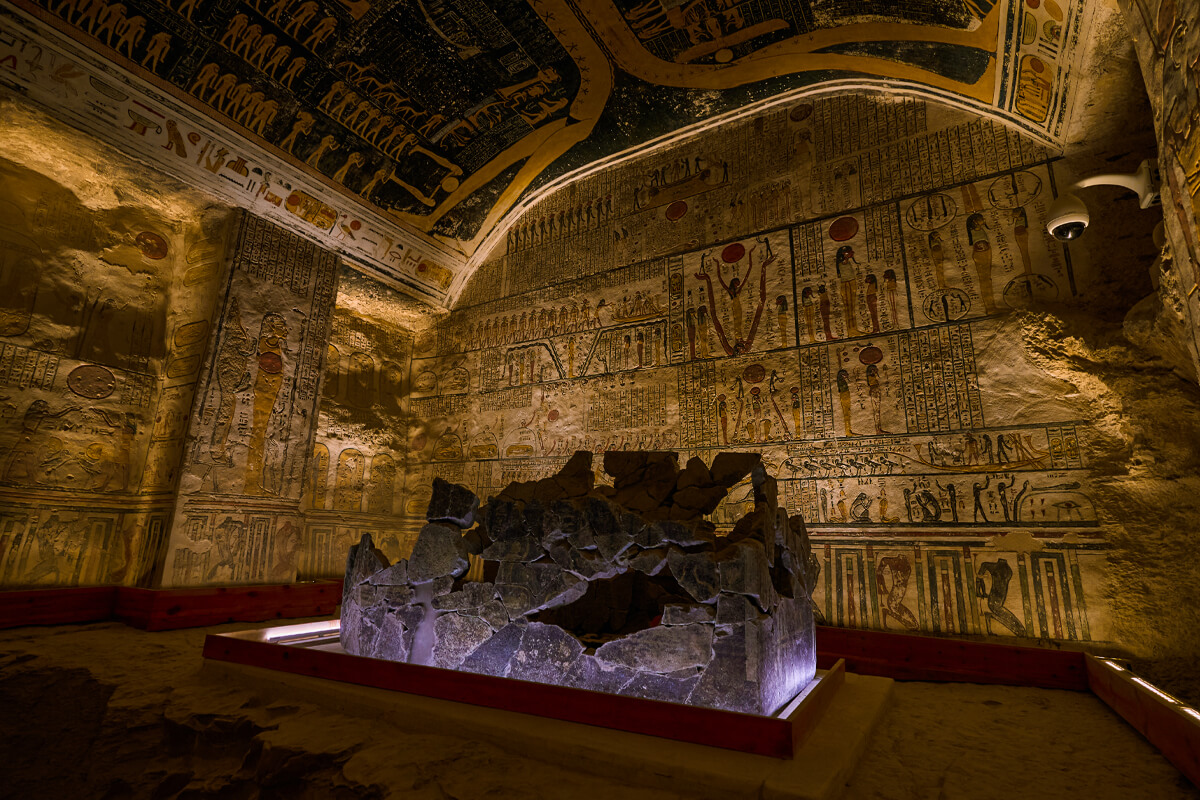
Few locations generate as much curiosity as the ancient Egypt map Valley of the Kings, and for good reason. Located on the west bank of the Nile opposite Luxor, this narrow desert valley served as the primary royal burial ground for pharaohs of the New Kingdom, roughly from 1550 to 1070 BCE. Any ancient Egypt Valley of the Kings map shows dozens of tombs cut directly into limestone cliffs, including the tomb of the young pharaoh Tutankhamun, discovered largely intact in 1922 and still one of archaeology’s most famous finds.
The choice of location wasn’t random. Ancient Egyptians selected this valley specifically because of its remote, easily guarded position and a naturally pyramid-shaped mountain peak, El-Qurn, that rises above it, believed to have held religious significance connecting the site symbolically to the pyramid-building tradition of earlier dynasties. A map of ancient Egypt Valley of the Kings typically shows this peak overlooking the entire burial ground, reinforcing why New Kingdom pharaohs chose hidden, rock-cut tombs over the more exposed pyramid structures of their ancestors.
The broader west bank of Thebes, shown on any complete map of ancient Thebes Egypt, includes far more than just the Valley of the Kings. The Valley of the Queens sits nearby, home to the stunningly decorated tomb of Queen Nefertari. Mortuary temples, including the massive temple of Hatshepsut and the Colossi of Memnon, line the base of the cliffs closer to the river, serving as public worship sites connected to the hidden royal tombs deeper in the desert.
This layout reflects the same east-west symbolism discussed earlier: the living city and its temples on the sunrise side, and the dead pharaohs and their tombs on the sunset side. For travelers, understanding this pattern transforms a visit from simply “seeing old tombs” into recognizing a deliberate, symbolic geography designed to connect the living world with the eternal one.
Practical tip for 2026 travelers: the Valley of the Kings gets extremely hot by midday, especially between May and September, so early morning visits are strongly recommended, both for comfort and for better lighting inside the tombs. Combining a Valley of the Kings visit with Hatshepsut’s Temple and the Colossi of Memnon in a single morning tour is one of the most efficient and rewarding ways to experience ancient Thebes, and it’s a route that Egypt All Inclusive builds into its most popular Luxor itineraries for exactly this reason.
Deserts of Ancient Egypt: Sahara, Libyan and Arabian Desert on the Map
A complete map of ancient Egypt deserts reveals just how much of the country was, and still is, uninhabitable desert. In fact, roughly 90 to 95 percent of Egypt’s total land area falls outside the narrow Nile Valley and Delta, meaning the vast majority of any accurate map of ancient Egypt Sahara desert is simply open sand and rock. This isn’t a minor detail; it’s central to understanding why Egyptian civilization concentrated so intensely along the river.
To the west of the Nile lies the Western Desert, part of the broader Sahara, which ancient Egyptians and modern geographers alike often refer to using the term map of ancient Egypt Libyan Desert. This region includes several important oases, including Siwa, Bahariya, Farafra, Dakhla, and Kharga, which functioned as vital stopping points for trade routes and, in some periods, as places of exile or refuge. Siwa Oasis, in particular, holds a famous place in history as the location Alexander the Great visited to consult the Oracle of Amun, cementing its symbolic importance far beyond its small size.
To the east of the Nile Valley lies a different desert entirely, often labeled on a map of Arabian Desert in ancient Egypt or Eastern Desert. This region is more mountainous and rugged than the Western Desert, and it historically served as a source of valuable resources, including gold, copper, and specific stones used in construction and jewelry. Ancient trade and mining routes crossed this desert toward the Red Sea coast, connecting Egypt to valuable maritime trade networks reaching toward Arabia and beyond.
Together, these two desert zones functioned almost like natural fortress walls. A map of ancient Egypt with deserts makes this immediately visible: the fertile Nile corridor sits protected between two vast, difficult-to-cross wastelands, with the Mediterranean Sea sealing the north and the First Cataract marking a natural chokepoint to the south. This combination of natural barriers is one of the key reasons ancient Egyptian civilization enjoyed such remarkable political and cultural continuity compared to more exposed regions.
For today’s travelers, these deserts remain genuinely spectacular. A guided excursion into the Western Desert’s White Desert or Siwa Oasis offers a dramatically different experience from the Nile-focused classics, otherworldly chalk formations, star-filled night skies, and a real sense of the isolation that shaped so much of ancient Egyptian identity. Adding a desert excursion to a Nile-based itinerary gives 2026 travelers a far more complete picture of the country’s ancient geography than the river alone ever could.
Sinai Peninsula and the Eastern Gateway of Ancient Egypt
The map of ancient Egypt Sinai Peninsula deserves its own dedicated discussion, since this triangular landmass functioned as ancient Egypt’s most important land bridge to the wider ancient Near East. Located east of the Nile Delta and separated from mainland Egypt by the Suez region, the Sinai connected Egypt directly to the Levant, modern-day Israel, Palestine, and Jordan, and onward toward Mesopotamia.
This connection made Sinai both a valuable trade corridor and a frequent military frontier. Ancient Egyptian forces regularly campaigned through Sinai to project power into Canaan and beyond, while foreign armies occasionally used the same route to threaten Egypt itself.
A map of ancient Egypt and surrounding countries almost always highlights Sinai as the primary overland connection point between Egypt and the rest of the ancient Near Eastern world, since sea travel, while used, was considerably riskier and less common for large-scale movement of armies and goods.
Sinai also held valuable mineral resources, particularly turquoise and copper, mined at sites like Serabit el-Khadim. Ancient Egyptian expeditions to this region left behind inscriptions that have proven enormously valuable to modern historians studying the development of early alphabetic writing, since some of the earliest known proto-alphabetic scripts were found carved by workers at Sinai’s mining sites.
For travelers today, the Sinai Peninsula offers a completely different kind of Egyptian experience. While the ancient Egyptian sites here are less monumental than Luxor or Giza, the region’s connection to biblical history, particularly Mount Sinai and Saint Catherine’s Monastery, one of the world’s oldest continuously operating monasteries, draws a significant number of visitors each year. Combined with the Red Sea coastline’s world-class diving and beach resorts, Sinai works well as either a standalone add-on or a relaxing conclusion to a longer historical tour through the Nile Valley.
Understanding Sinai’s ancient role as a gateway rather than a core Egyptian heartland also helps explain some of its distinct character today, culturally and historically connected to Egypt, yet always slightly separate from the Nile-focused world that produced most of the monuments travelers come to see.
Ancient Egypt and Nubia: The Map of Kush and the Southern Frontier
South of the First Cataract, any accurate map of ancient Egypt and Nubia enters a region with its own rich, distinct civilization: Nubia, and later the powerful Kingdom of Kush. A map of ancient Egypt Kush typically shows this territory stretching along the Nile from roughly modern-day Aswan deep into present-day Sudan, encompassing important centers like Kerma, Napata, and eventually Meroë.
The relationship between ancient Egypt and Nubia was complex and shifted dramatically across different periods. During the Old and Middle Kingdoms, Egypt often treated Nubia as a valuable trading partner and, at times, a military rival, prized especially for gold, ivory, exotic goods, and skilled archers who frequently served in Egyptian armies.
A map of ancient Nubia and Egypt from the Middle Kingdom period typically shows a string of Egyptian fortresses built specifically to control trade and movement along this southern frontier, particularly near the Second Cataract.
By the New Kingdom, Egypt had expanded direct control deep into Nubian territory, and this expanded reach is clearly visible on any map of ancient Egypt and Nubia from that era, extending Egyptian influence as far south as the Fourth or even Fifth Cataract at times. Nubian culture and Egyptian culture blended significantly during this period, and many Nubian elites adopted Egyptian customs, religious practices, and even hieroglyphic writing.
Remarkably, this relationship eventually reversed. Centuries later, the Kingdom of Kush grew powerful enough to conquer Egypt itself, and Kushite pharaohs ruled as Egypt’s 25th Dynasty around 744 to 656 BCE. A map of ancient Egypt and Kush from this period actually shows Kushite territory extending north to include the entire Nile Valley, a striking reversal of the earlier power dynamic and a powerful reminder that ancient Egyptian history was never a story of one static, unchanging kingdom, but rather a constantly shifting relationship between multiple African civilizations along the same great river.
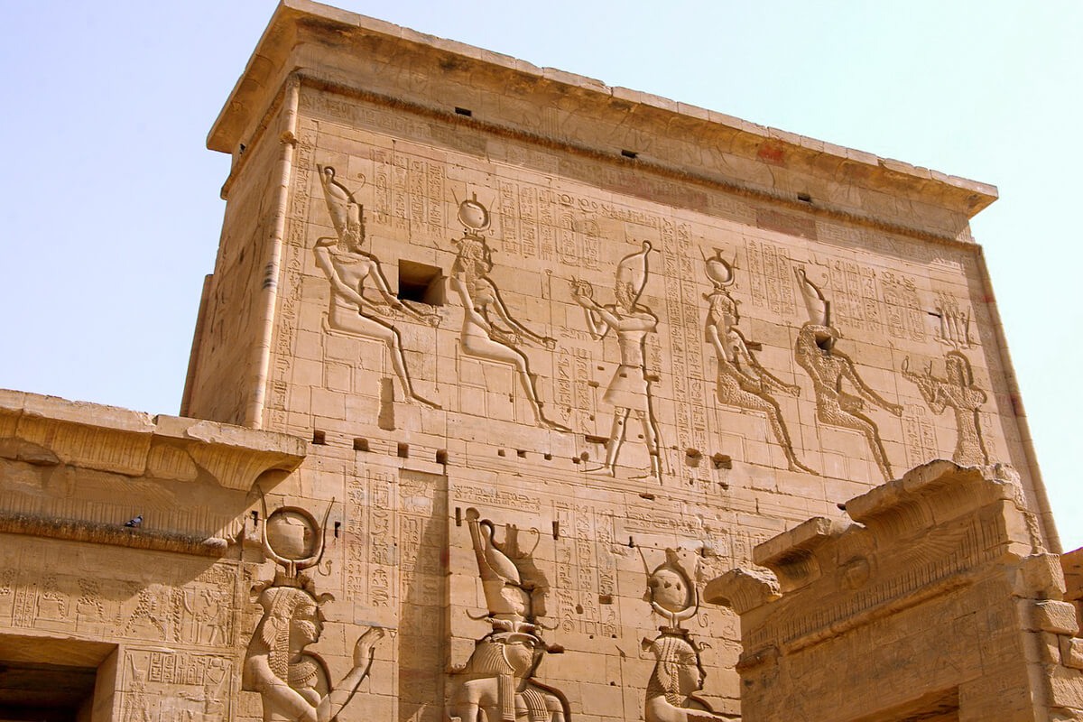
For travelers with a deep interest in this less-visited chapter of history, Aswan offers the best modern gateway into ancient Nubian heritage, including the Nubian Museum and nearby Nubian villages along the Nile, alongside the more famous Aswan sites like Philae Temple and the Unfinished Obelisk. Extending a Nile itinerary slightly further south than the typical Luxor-to-Aswan route offers a genuinely unique perspective that most standard Egypt trips miss entirely.
How the Map of Ancient Egypt Changed: Old, Middle and New Kingdom Borders
One of the most common misconceptions travelers and students bring to this topic is imagining ancient Egypt as a single, unchanging territory. In reality, a map of ancient Egypt old kingdom looks noticeably different from a map of ancient Egypt new kingdom, and understanding these shifts adds enormous depth to any visit or study of the civilization.
During the Old Kingdom (roughly 2686 to 2181 BCE), Egyptian territory was relatively modest, focused tightly on the Nile Valley and Delta, with Memphis serving as the political capital.
This was the great age of pyramid building, and a map of ancient Egypt old middle and new kingdom comparison shows this period with minimal expansion beyond the traditional Egyptian heartland, though trade contacts with Nubia, the Levant, and Punt (likely located in the Horn of Africa region) were already well established.
The Middle Kingdom (roughly 2055 to 1650 BCE) saw Egypt strengthen its grip on Nubia, building a chain of massive fortresses along the Nile south of the First and Second Cataracts to secure trade routes and gold-mining regions. This period also saw increased attention toward the Sinai Peninsula and Eastern Desert resources. A map of ancient Egypt from this era shows a more consolidated, defensively organized state compared to the Old Kingdom.
The New Kingdom (roughly 1550 to 1070 BCE) represents ancient Egypt at its largest and most powerful. During this period, Egyptian military campaigns extended control deep into Nubia to the south and into the Levant to the northeast, creating something close to an empire rather than a purely regional kingdom. A map of ancient Egypt empire from this period would show Egyptian influence stretching from deep in Nubia all the way to parts of modern Syria, an extraordinary expansion compared to earlier eras.
This gradual expansion and later contraction, Egypt’s borders shrank again in later periods due to internal fragmentation and foreign invasions, mirrors the broader rise-and-fall pattern seen throughout ancient history. For anyone visiting Egypt in 2026, recognizing which sites belong to which kingdom adds tremendous context: Giza and Saqqara belong overwhelmingly to the Old Kingdom, while Luxor’s greatest temples and the Valley of the Kings belong to the New Kingdom’s golden age of imperial power and wealth.
Ancient Egypt on the World Map: Neighbors, Trade Routes and Mesopotamia
Zooming out to a world map of ancient Egypt places the civilization within its broader ancient Near Eastern context, and comparing it to its most famous neighboring civilization, Mesopotamia, highlights just how differently geography shaped these two great river civilizations. A map of ancient Mesopotamia and Egypt typically shows Mesopotamia positioned between the Tigris and Euphrates rivers in modern-day Iraq, while Egypt sits along the Nile further west and south.
Despite both being classic “river valley civilizations,” their geography produced very different historical experiences. Egypt’s deserts on either side of the Nile provided strong natural protection, contributing to long periods of political stability and continuity. Mesopotamia, by contrast, sat on much more open, exposed terrain between two rivers, making it far more vulnerable to frequent invasion and, as a result, home to a much more rapid succession of different ruling civilizations, Sumerians, Akkadians, Babylonians, and Assyrians, over similar timeframes.
Here’s a simple comparison that helps clarify these key differences for readers exploring an ancient map of Mesopotamia and Egypt side by side:
| Feature | Ancient Egypt | Ancient Mesopotamia |
|---|---|---|
| Main River(s) | Nile River | Tigris and Euphrates |
| Natural Protection | Deserts on both sides | Open, exposed plains |
| Political Continuity | Long, relatively stable dynasties | Frequent changes in ruling civilizations |
| Flooding Pattern | Predictable, annual | Less predictable, sometimes destructive |
| Famous Writing System | Hieroglyphics | Cuneiform |
| Key Cities | Memphis, Thebes, Alexandria | Babylon, Ur, Nineveh |
Trade and diplomatic contact between these civilizations was significant, especially during the New Kingdom, when Egypt’s imperial reach extended into the Levant, bringing it into direct contact with Near Eastern powers. A map of ancient Egypt Jerusalem connection is worth noting here too: while Jerusalem itself became more historically prominent slightly later, the broader Levantine region, including areas near modern Jerusalem, fell within Egypt’s sphere of influence and military campaigns during parts of the New Kingdom.
Understanding Egypt’s place within this wider ancient world helps travelers appreciate that Egyptian civilization didn’t develop in isolation. It traded, fought, and exchanged ideas with neighboring cultures across the Mediterranean, the Near East, and Africa, making a single trip to Egypt feel connected to a much larger story of ancient human civilization as a whole.
Reading a Labeled or Blank Map of Ancient Egypt: A Simple Guide for Beginners and Students
If you’re a student, teacher, or simply someone who wants to properly understand a labeled map of ancient Egypt or fill in a blank map of ancient Egypt for an assignment, a clear step-by-step approach makes the process far less overwhelming.
Start with the Mediterranean Sea at the top of the map, this is your fixed northern reference point. Directly below it, mark the Nile Delta, the fan-shaped area where the river splits into multiple branches. This entire region represents Lower Egypt. Moving further down (south), draw a long, narrow line representing the Nile River itself, stretching all the way to the First Cataract. This entire corridor represents Upper Egypt.
Next, place your key cities in order from north to south: Alexandria near the Mediterranean coast, Memphis and Giza just south of the Delta, then a long gap before reaching Abydos, Dendera, and finally Thebes (Luxor and Karnak) roughly two-thirds of the way down the valley. Continue further south to Edfu, Kom Ombo, and finally Aswan, marking the location of the First Cataract and the traditional southern border of ancient Egypt proper.
For a more detailed map of ancient Egypt, add the two desert regions: the Western (Libyan) Desert to the left of the Nile Valley, and the Eastern (Arabian) Desert to the right, extending toward the Red Sea. Include the Sinai Peninsula as a separate triangular landmass northeast of the Delta, connected to mainland Egypt but distinct from it. Finally, mark Nubia and the region of Kush extending south beyond the First Cataract, if your assignment covers this broader historical relationship.
This same step-by-step logic works whether you’re completing a map of ancient Egypt blank template for a classroom exercise, studying images of ancient Egypt map resources for research, or simply trying to visualize the region before a trip. The key is always building outward from the same three fixed points: the Mediterranean Sea, the Nile River’s course, and the First Cataract. Once those three elements are in place, everything else, cities, deserts, neighboring regions, falls naturally into position around them.
Travelers preparing for a 2026 trip often find this same exercise surprisingly useful in a completely different way. Sketching out (even mentally) where you’ll be traveling relative to the Nile Valley helps enormously when planning logistics, since nearly every major site in Egypt sits along this same historical corridor.
From Ancient Maps to Modern Journeys: How to Use This Knowledge When Planning Your 2026 Egypt Trip
Understanding the ancient map of Egypt isn’t just an academic exercise, it’s genuinely one of the most useful things a traveler can do before visiting the country. Once you understand that nearly all major ancient sites sit along the Nile Valley or its immediate surroundings, planning an efficient, satisfying itinerary becomes far easier.
A classic and highly efficient 2026 itinerary typically follows the ancient map almost exactly: starting in Cairo to explore Giza, Saqqara, and the Egyptian Museum (representing the Old Kingdom heartland), flying or cruising south to Luxor to explore Karnak, Luxor Temple, and the Valley of the Kings (representing the New Kingdom’s peak), then continuing to Aswan to see Philae Temple, the High Dam, and Nubian culture (representing the ancient southern frontier). This route mirrors the historical development of the civilization itself, moving chronologically as well as geographically.
For travelers with additional time, extending the itinerary to include Alexandria adds the later Greco-Roman chapter of Egyptian history, while a desert excursion to Siwa Oasis or the White Desert adds the dramatic, often-overlooked western frontier that shaped so much of ancient Egyptian isolation and identity. Each of these additions corresponds directly to a specific region on the historical map, giving your trip genuine historical logic rather than simply hopping between disconnected tourist attractions.
Timing matters too. Understanding the Nile’s ancient flooding cycle helps modern travelers appreciate why certain months feel different when visiting: while the Aswan High Dam now controls flooding, Egypt’s climate still follows the same broad seasonal patterns that shaped ancient agricultural life, cooler and more comfortable from October through April, considerably hotter from May through September, particularly in Upper Egypt and the desert regions.
Here’s a quick planning table connecting ancient regions to modern 2026 travel priorities:
| Ancient Region | Modern Destination | Best For |
|---|---|---|
| Lower Egypt / Memphis area | Cairo, Giza, Saqqara | Pyramids, museums, Old Kingdom history |
| Upper Egypt / Thebes | Luxor | Temples, Valley of the Kings, New Kingdom grandeur |
| Southern Frontier | Aswan | Nubian culture, Philae Temple, Nile cruises |
| Nile Delta / Greco-Roman Egypt | Alexandria | Mediterranean coast, later Egyptian history |
| Western Desert | Siwa, White Desert | Oases, desert landscapes, off-the-beaten-path travel |
Approaching your trip this way, region by region, following the same logic as the ancient map itself, tends to produce a far more coherent and memorable experience than a rushed, scattered itinerary. It’s precisely this kind of thoughtful, historically grounded planning that separates an average Egypt trip from an exceptional one.
Unique Tips: How Egypt All Inclusive Turns the Ancient Map of Egypt into a Real Itinerary
At Egypt All Inclusive, we believe the best way to experience ancient Egypt is to actually follow its historical geography rather than jump around randomly between famous names. Here are practical, insider tips we give our own travelers, tips you won’t find on a typical tourist blog.
Follow the river, not just the highlights. Instead of flying directly between cities, consider a Nile cruise between Luxor and Aswan. This lets you watch the landscape shift exactly the way ancient Egyptians experienced it, farmland suddenly giving way to desert cliffs, small riverside villages appearing between temple stops. It’s the closest modern travelers can get to experiencing the ancient map in motion rather than as a static image.
Visit the West Bank of Luxor in the early morning. The Valley of the Kings, Hatshepsut’s Temple, and the Colossi of Memnon are all far more comfortable, and far better lit for photography, before 10 a.m., especially between May and September. Our guides schedule West Bank tours first thing in the morning specifically for this reason.
Don’t skip Saqqara and Dahshur. Most travelers only visit Giza, missing the chance to see the Step Pyramid and the Bent and Red Pyramids, sites that tell the actual engineering story behind Giza’s perfection. We include these in our extended Cairo itineraries because they genuinely change how travelers understand the pyramids.
Consider extending south to Nubian villages near Aswan. Very few standard tour packages include this, yet it offers a rare, authentic glimpse into a culture with roots stretching back to ancient Nubia and Kush, alongside spectacular Nile scenery near the First Cataract.
Time your trip around comfortable temperatures. October through April offers the most pleasant conditions for exploring outdoor sites like Karnak, Giza, and Abu Simbel. If you must travel in summer, plan outdoor visits for early morning or late afternoon.
Pair ancient history with a Red Sea or Sinai extension. After days of temples and tombs, a few days in Hurghada or Sharm El Sheikh offers a relaxing, scenic contrast, while still connecting historically to ancient Egypt’s eastern trade routes and mining expeditions.
These are exactly the kind of details our travel designers build into every custom itinerary. Rather than offering a generic checklist tour, Egypt All Inclusive designs each 2026 journey around the logic of the ancient map itself, ensuring every day builds naturally on the last.
Frequently Asked Questions about the Ancient Egyptian Map of Egypt
What is the difference between Upper and Lower Egypt on a map?
Upper Egypt refers to the southern Nile Valley, upstream toward the river’s source, while Lower Egypt refers to the northern Nile Delta region, downstream near the Mediterranean Sea.
Why does a map of ancient Egypt with the Nile look different from a modern map?
Ancient maps often emphasize the Nile Valley and Delta almost exclusively, since these were the only densely populated regions, while modern maps show full national borders including largely uninhabited desert territory.
What does a map of ancient Egypt and Mesopotamia show about their relationship?
It shows two separate river valley civilizations connected by trade and, at times, military contact through the Sinai Peninsula and the Levant, despite being geographically distinct regions with different rivers and different levels of natural protection.
Where was ancient Thebes located on the map?
Ancient Thebes sat along the Nile in Upper Egypt, corresponding to modern Luxor, with temples on the east bank and royal tombs on the west bank.
What is shown on a map of ancient Egypt with cataracts?
These maps highlight the rocky, shallow stretches of the Nile, numbered First through Sixth, that historically marked boundaries and challenges for river navigation between Egypt and Nubia.
Is Alexandria part of ancient Egypt’s map?
Yes, though it was founded later than most classic ancient Egyptian sites, around 331 BCE, making it part of Egypt’s Greco-Roman era rather than its earliest dynastic period.
What deserts surround the map of ancient Egypt?
The Western (Libyan) Desert lies to the west of the Nile, part of the Sahara, while the Eastern (Arabian) Desert lies to the east, extending toward the Red Sea.
How did the map of ancient Egypt change between kingdoms?
It expanded significantly during the New Kingdom, reaching deep into Nubia and parts of the Levant, compared to the more modest territory held during the Old and Middle Kingdoms.
Conclusion: Bringing the Ancient Map of Egypt to Life in 2026
The ancient Egyptian map of Egypt tells a story far richer than lines on paper, it explains why cities rose where they did, why pyramids stand at Giza, why tombs hide in a remote valley at Thebes, and why an entire civilization thrived along one narrow, fertile ribbon of land surrounded by desert. From Upper and Lower Egypt to Nubia, Sinai, and the Nile Delta, every region on that ancient map still shapes the journey travelers take today. Understanding this geography doesn’t just satisfy curiosity, it transforms a simple vacation into a genuinely meaningful journey through one of history’s greatest civilizations.
If reading about this ancient map has left you wanting to see it in person, there has never been a better time to book than 2026. Egypt All Inclusive stands as the best travel agency in Egypt in 2026, offering expertly designed itineraries that follow the same historical logic covered in this guide, from Cairo’s pyramids to Luxor’s temples, Aswan’s Nubian heritage, and beyond. Our local expertise, carefully planned routes, and genuine passion for Egyptian history mean every trip we design turns ancient geography into unforgettable, real-world memories.
Don’t just read about the map of ancient Egypt, walk it. Contact Egypt All Inclusive today to book your custom 2026 Egypt tour and experience this incredible civilization exactly the way it was meant to be seen.